
In the past ten years, few other areas of technology have expanded quite as rapidly as that of unmanned aerial vehicles. From supply delivery to security, drones have found utility across nearly every industry. Of all the advantages drone use offers, however, one of the most valuable is their ability to provide multispectral imagery and photogrammetry to users of all skill sets.
Spectral imaging can be prohibitively expensive, with cameras carrying price tags of several thousand dollars. Photogrammetry, however, can be performed with nearly any digital imaging system with an intervalometer on the camera. With the right altitude and software, even the ubiquitous Go-Pro cameras found across the drone industry can create marketable maps and models.
Photogrammetry, also known more simply as surveying and mapping, is a highly in-demand business with a relatively low barrier to entry. Drone pilots and business owners wanting to enter the industry will most likely already have the platforms and hardware necessary to conduct an aerial survey. To process the imagery into products, however, specialized software is required.
There are two main industry leaders in photogrammetry software: Pix4Dmapper and DroneDeploy. Both of these programs have staunch supporters, and neither is definitively better than the other. They do, however, have different strengths and weaknesses. To decide which is most suitable for your business, consider the type and scope of the products you want to deliver. Then, check out how these two software platforms stack up in the areas most important to your mission.
Cloud Processing vs. Local Processing
Local (or desktop) processing of data is the industry gold standard for accuracy and processing speed but it is less convenient than cloud processing. Pix4D boasts a hybrid platform that allows you to work on a project between and across devices. Drone Deploy, on the other hand, is an exclusively cloud-based app available only for iOS and Android operating systems. Although cloud processing has made tremendous progress in the past few years, it still falls short in a few key areas such as accuracy.
Ground Control Points
These visual markers are a crucial tool for increasing the accuracy of your models and maps, especially when the required measurements are non-relative. Previously, this was an area in which Pix4Dmapper held a clear advantage due to the superior processing power of desktop applications. Earlier iterations of the DroneDeploy app did not support multiple GCPs, however, both software platforms are now capable of processing a map with a large number of them.
An important note here is that although DroneDeploy is capable of using GCPs, the feature is only available with either the Enterprise plan or for an additional $49 per map for Business plan users. This add-on price can quickly become prohibitively expensive.
Accuracy
Pix4Dmapper is a professional quality software platform, with the ability to collect survey-grade data with <1 cm accuracy. DroneDeploy, on the other hand, ranges between 1 cm and 5 cm accuracy even with sufficient GCPs and checkpoints. For projects where precision is paramount, Pix4D comes out on top.
Measurements and calculations
One of the more common applications of commercial drone imaging is stockpile and inventory measurement. In this type of survey, the dimensions of piles of loose material such as coal are measured in precise detail and the volume is calculated. Both DroneDeploy and Pix4D offer the ability to perform this function instantly.
Assuming an uncomplicated base surface for the stockpile, DroneDeploy claims on its website to be capable of volume measurement accuracy within 1-2% of laser methods. Interestingly, Pix4D only claims to perform at 2-5% volumetric accuracy despite several user anecdotes of considerably better results.
Models
Digital models are a highly in-demand product across numerous industries. Land surveying, once a painstaking and lengthy process, can be performed astoundingly fast using terrain models. The construction industry often commissions surface and 3D models to track progress at their sites, create complex and accurate analyses of damaged buildings, and accurately calculate distances. Many energy companies have built infrastructure in difficult-to-reach locations, such as power lines and windmills on top of mountains. They can dramatically increase personnel safety by conducting inspections through 3D models, especially paired with multispectral imagery.
3D textures
3D textured mesh is a feature that projects a more photorealistic face onto your models. It is a tool for display rather than measurement but can be highly useful for applications such as virtual touring. Both Pix4Dmapper and DroneDeploy offer this capability. However, Pix4D has the option of adding LOD (level of details) mesh, a feature that breaks the model into multiple layers of detail that can increase or decrease model complexity. For clients who wish to view their model on platforms with different processing capabilities.
3D point cloud
DroneDeploy has made major strides in this area after releasing its Structures mode, which processes complex vertical and horizontal data into a point cloud 4x as dense as its Terrain mode. The resulting model is extremely precise when used with GCPs and is visually appealing even without a textured mesh. Pix4Dmapper also generates fantastic quality point cloud models and has the additional feature of optional filling and smoothing to improve planarity and complete critical areas.
Digital Surface and Terrain
Both of these popular photogrammetry platforms offer excellent DSM, DTM, and elevation models with comparable visual quality when used with GCPs.

Maps in DroneDeploy and Pix4Dmapper
LiveMap
DroneDeploy’s LiveMap is an extremely unique feature with the potential to be extremely useful for your business. LiveMap offers real-time photogrammetry products during the drone’s flight without having to upload the images for external processing or requiring internet access. Although the map produced is low resolution and 2D only, it can process both visible light imagery and thermal imagery. This ability is incredibly valuable for emergency services such as wildfire response. Pix4Dmapper does not offer a similar service.
Orthomosaics
These 2D maps are used for distance and area measurements as well as simple visual information and are highly in demand in the real estate industry. Both DroneDeploy and Pix4D produce orthomosiac maps of comparable quality. However, Pix4D also includes Mosaic Editor, a tool that can clean up noise and undesirable objects.
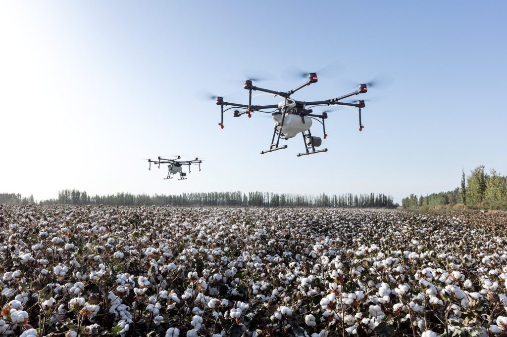
Reflectance/NVDI/Spectral
Used most often with thermal and multispectral imagery, this type of map doesn’t balance pixel weights. It is most often used in precision agriculture and forestry to help determine plant health and map problem areas. Both platforms are industry leaders for this type of map and produce comparable quality deliverables. Additionally, both platforms perform superbly in taking reflectance maps and compiling them into index maps with radiometric accuracy.
DroneDeploy recently added support for spectral imagery, but it is specialized for crop analysis. Pix4Dmapper has extended multispectral mapping functionality, including the ability to merge and layer the resulting maps with RBG maps.
Worth noting in this category is that DroneDeploy offers automated plant health and crop stress algorithms and analysis as a part of its Business level plan, but pix4D has a separate product (pix4Dag) that performs these specialty functions. Pix4Dmapper will take and process the footage, but analyses of the results must be done separately.
Thermography
Although both platforms offer extremely accurate thermographic image processing, both radiometric and non-radiometric, Drone Deploy limits its use to its Enterprise customers.
Ease of use: DroneDeploy vs. Pix4dmapper
Both Drone Deploy and Pix4Dmapper offer quality photogrammetry products. However, their user experience is notably different in several ways.
Flight planning
This is one area in which there is a clear difference between the two platforms. DroneDeploy offers a feature to map and execute the flight plan automatically without needing pilot input. While Pix4d has software that also does this, Pix4Dmapper is not one of them. For newer or less experienced pilots, this feature can go a long way toward producing steady, high-quality imagery from which to create maps and models.
Hardware compatibility
DroneDeploy originally developed as a DJI-only platform, and for the most part, this is still true, except for the recently added Skydio 2. Additionally, the software is mostly compatible with DJI cameras alone, although it has been starting to extend some limited support to a few select outside models. Pix4Dmapper is designed to handle most DJI, Parrot, and Yuneec drone platforms, and able to process imagery from any camera or platform.
Interface
Although Pix4Dmapper offers superb functionality, one of the main complaints by users is that it is a fairly difficult platform to navigate and to learn. On the other hand, DroneDeploy’s intuitive and user-friendly interface has been widely praised by drone pilots of all skill levels and designed with beginners in mind.
Team management and collaboration
Pix4Dmapper allows collaboration between Pix4d users, but that is the extent of its team support capabilities. DroneDeploy’s Enterprise plan, however, has a deluxe suite of capabilities to fully support team management. Its specialized dashboard has features such as activity auditing, automatic certification compliance checks for your team, role and permissions management, and more.
Export compatibility
One major weakness of DroneDeploy is its limitations for export formats. The only supported file types are JPG, GeoTIFF, DXF/SHP, ShapeFile, OBJ, LAS, XYZ, RCP, PDF, and ZIP. Pix4D, on the other hand, can export its images in over 20 file formats.
Price point and scalability
Pix4Dmapper has a flat monthly rate of $350, or an annual fee of $3500. Alternatively, you can purchase a lifetime license for your business for $4990. This price includes all of the features the software contains without any exclusions. The fine level of control offered by the various features makes it incredibly easy to scale from small projects to large ones.
DroneDeploy is more complicated with its pricing model and has raised its fees considerably in recent years, currently offering three paid tiers. The Pro tier, the least expensive of the options, runs at $149 monthly or $1200 annually and has basic 2D mapping functionality for single person use. The Business tier is $449 monthly or $3600 annually and includes most of the available features, although a few are pay-per-map. The Enterprise tier includes all photogrammetry features as well as the robust team management features, but the pricing is customized to your business and not publicly listed.
Conclusions – DroneDeploy or Pix4Dmapper?
Pix4Dmapper is excellent for most industries, but pix4d offers other specialty software suites that are worth looking into if you are going to work in agriculture or inspections. Even without the calculation shortcuts available with Pix4Dfields and Pix4Dinspect, however, it is an incredibly powerful and professional tool that offers precise, accurate photogrammetry products.
Drone Deploy has progressed far enough that it works perfectly well for beginner, intermediate, and some professional work. For specialty work, high-precision surveys, and complex analyses, however, Pix4Dmapper comes out ahead. On the other hand, if you are running a larger scale business with multiple pilots, it may be worthwhile to pay for DroneDeploy’s Enterprise tier for its team management tools and automated flight system. Alternately, if you operate alone and your primary focus is providing basic mapping services, the Pro tier may perform well while saving you money.
Before choosing, make sure to take advantage of the free trials offered by each platform. Pix4Dmapper’s 15-day trial gives you access to the whole suite of features and is a perfect opportunity to see if the software is a good fit for you and your team. DroneDeploy has a 14-day trial, but it is limited to the Business tier features.