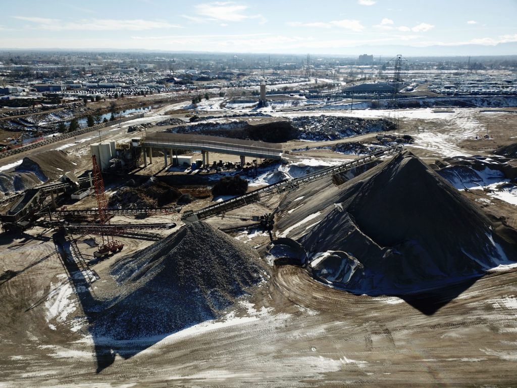
Through a process called drone mapping, camera drones collect high-quality overlapping aerial photographs from many angles and vantage points to create a 2D or 3D map of a given area or site. As a result, drones have many powerful applications across commercial, industrial, residential and agricultural industries.
Drone mapping is the process of using a series aerial photos taken by a drone to create a detailed 2D or 3D map of a given area or site. This map can then be used for a variety of business purposes including home inspections, analyzing crops, evaluating a piece of land for a potential construction project, and much more.
When creating a 3D map, the process involves a technique called photogrammetry. Photogrammetry involves taking multiple overlapping photos and then using software to derive measurements from these photos to create 3D models of either objects or scenes. The use of photogrammetry in topographic mapping is well established. However, in recent years photogrammetry has been widely applied across many fields, and drones have played a large part in this expansion. These fields include architecture, forensics, engineering, medicine, and geology.
Note that the basic principle behind this technique is very similar to the way most smartphone cameras nowadays allow you to create a visually appealing panorama by stitching together overlapping photos into a 2D mosaic. However, photogrammetry takes this concept a step further by using the camera position as it moves through 3D space in order to estimate X, Y, and Z coordinates for every pixel of the original image.
Because drone photographs are embedded with metadata containing an exact GPS location including elevation, a series of photographs taken of a given area or site can be quickly interpreted by drone mapping software to create a detailed an accurate 2D or 3D map of an area.
What is photogrammetry?
In short, photogrammetry is the process of making measurements from aerial photographs. Photogrammetry is a 3D coordinate measuring technique that utilizes 2-D photos and a known scale length as its core tools. In simple words, the distance between two points on any object can be determined if you measure them in a picture and then apply a suitable scaling factor. In the case of drone mapping, scaling factor is calculated using software that reads the GPS coordinates logged by the drone at the moment each photo was taken.
Note that the fundamental principle behind photogrammetry is called triangulation or aerial triangulation. By taking photos from at least two different locations, lines of sight are developed from each camera angle to several points on an object. These lines of sight are then intersected mathematically (or in the case of drones, using drone mapping software) to produce three-dimensional coordinates of the relevant points.
How does photogrammetry work?
There is no doubt that photogrammetry is an excellent tool for making an accurate digital model of complex objects. By using photogrammetry, drone surveyors can add more features and texture to an object or site than would be achievable with conventional 3D modeling or using 3D scanning. In most cases, photogrammetry is based mainly on perspective geometry. The camera lens operates as the perspective center, while the light rays travel toward the lens in straight lines from a point in the scene. They travel through the perspective center onto the image of the point.
Note that if you calibrate the camera, i.e., you know the principal distance (or focal length), you can calculate the angles between the light rays from several points. And given at least three points in the scene along with known 3D coordinates in a coordinate system, you can then determine the position of the perspective center as well as the orientation of the image with regard to that coordinate system.
Also, knowing the orientation and position of the image is important as it allows you to easily calculate the 3D vector from your image point through to the perspective center that corresponds to each light ray. And if you have two or more than two overlapping known images, you can intersect all the 3D vectors from each image and then determine the 3D position of these points in the scene.
In the case of drone photogrammetry, most of the heavy lifting involved in this calibration and math is shouldered by drone mapping software.
History of photogrammetry
If you think that photogrammetry is an invention of the modern era of computers and photography, you are both correct and incorrect. The expression of photogrammetry was initially used by the famous Prussian architect Albrecht Meydenbauer back in 1867 when he fashioned some of the earliest elevation drawings and topographic maps.
While digital photogrammetry certainly originated in the 1980s, in 1480 notable Italian inventor and Renaissance artist Leonardo Da Vinci recorded his theory of how we can incorporate perspectives into illustrations. And in the 1850s, the eminent French scientist Aimé Laussedat highlighted the immense potential for mapping from photography. He is often considered the “father of photogrammetry.”
Today, the instruments used in photogrammetry have become very sophisticated. Some of the more meaningful developments in the 2nd half of the 20th century included satellite photography, automatic visual scanning, large-scale photographs, high-quality color photographs, numerical photogrammetry, and heavy use of films sensitive to radiations that are beyond the visible spectrum.
What is drone photogrammetry and drone mapping?
Usually, photogrammetry entails taking measurements from imagery which is captured by drones, satellites, or airplanes. Drone photogrammetry is important as it makes it possible to model any area in 3D by utilizing metadata embedded in drone photographs which contain GPS coordinates.
Note that this development has opened new opportunities in the areas of technical inspection, professional measurement, and research. And the great thing is that it also allows the drone operators to provide an innovative service to their customers.
Photogrammetric surveying using drones
You probably know that drones now offer a cheaper and better alternative to aerial imaging surveys. Surveying is the accurate science of determining the positions of, as well as the distances between various points in both 2D and 3D space. Surveys are important as they provide critical and timely information that enables sound decision making ranging from design and upkeep of infrastructure and construction site planning to delineating cadastral property boundaries.
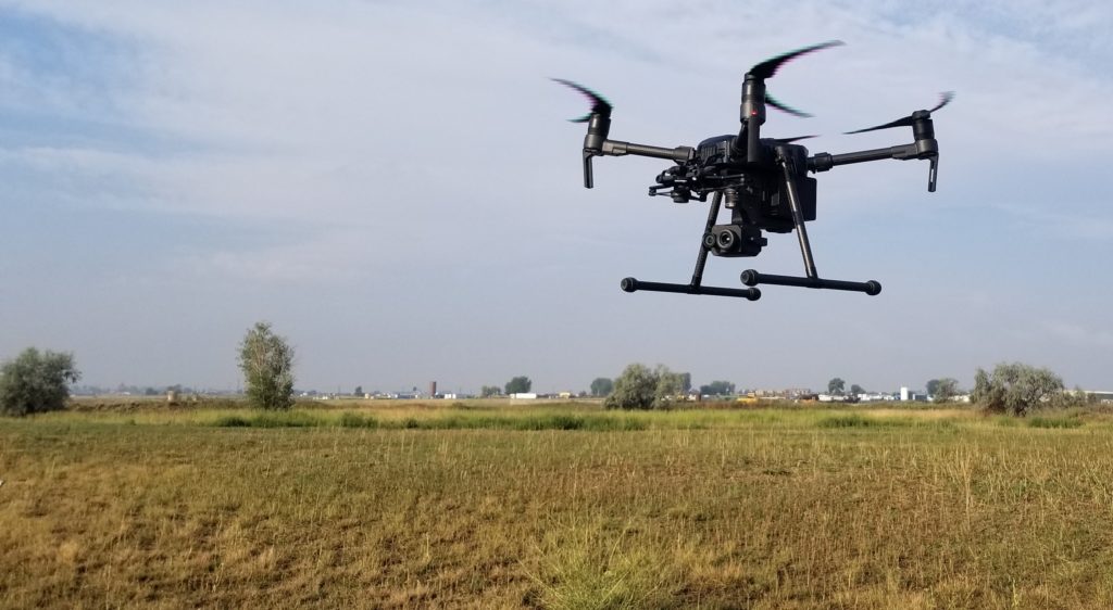
All you need for this purpose is a camera-equipped drone. You will find a wide selection of professional multirotor devices in the price range of $2,000 to $5,000. On the other hand, RTK/PPK-enabled sets are usually found in the price range of $5,000 to $20,000. Also, the second cost item you will need is photogrammetry processing software licensing. While you may decide to fly a drone on your own as many drone vendors now sell consumer-type drones that have cameras as well as photogrammetric software, this doesn’t guarantee good results.
You have a better option, which is to hire a drone mapping company. The company will do everything on your behalf, as drone mapping is now a highly specialized market led by seasoned and experienced professionals.
Learn more about Telos Aerial Imaging drone mapping services.
When surveying rough and challenging terrain, drones tend to make it unnecessary for human operators to physically access or measure points in difficult-to-reach or hazardous locations. In this way, consumer-operated drones have significantly expanded the possibilities of aerial mapping and photogrammetry.
Important components to photogrammetry capture
Note that there are four key components for effective photogrammetry capture, whether you’re in a controlled or uncontrolled environment. These are location, stillness, camera movement, and camera settings. If you pay close attention to these components, it will help reduce blurring, tiling, and other issues when you scan photogrammetry objects.
Location
During the post-processing of any photogrammetry model, most of the cleanup required will be due to bad or poor lighting conditions present when you are shooting in the field. You will likely find strange gray or white clumps, often known as “artifacts,” are affixed to your subject. One of the best ways to minimize these artifacts is that you capture your subject with suitable lighting (which can minimize shadows) and avoid any reflective or refractive surfaces. Drone mapping software, depending on its features, can help substantially in the processing involved.
Stillness
You may know that photogrammetry is best when it comes to making 3D models of a motionless object. As a result, if you are trying to create a model of something that may move, such as a person, advise the person not to move.
Camera movement
Note that you have to capture your entire subject. However, it is as important that your photogrammetry software fully understands your capture. So, capture quickly if you don’t want several hours of rendering or a wavering subject.
Camera settings
Keep in mind that photogrammetry tends to work best when capturing a consistently colored and formed reality. So, don’t make the mistake of changing your settings from one shot to another. It is important to keep your focus as deep and sharp as possible.
Drone 3D photogrammetry tips
Here are some tips you can use to excel in drone 3D photogrammetry.
Expand the area captured
It is important to ensure that you capture your images slightly beyond the extent of the relevant area of interest. Note that the reconstruction is often created from overlapping images. As a result, it might be biased or inaccurate if you capture a feature from just one side. Frequently, drone mapping software will allow you to pre-plan flight routes in advance in order to ensure that all angles are appropriately captured to form an accurate and detailed map rendering.
Think spatially
You have to ensure that you get all your angles. It is not ideal to begin a project from scratch simply because you forgot or ignored to take enough photographs of a landmass, or did not get any photos of that one piece that jutted out weirdly. Hence, you have to plan well. We generally advise using a pre-planned flight route for your drone mapping and photogrammetry missions.
Choose the best software for your specific needs
Keep in mind that choosing the best software for your needs will depend on several different factors. Software such as Pix4D and DroneDeploy offers amazing, dedicated tools to measure distances, areas, and even volumes.
Drone mapping and photogrammetry software options
Pix4D
Pix4D is a very popular and effective choice when it comes to photogrammetry software. This is because it is simple to use and also has a large user base. For any kind of drone or aerial overlapping imagery, Pix4D software gives you an excellent foundation in various photogrammetry tools.
DroneDeploy
DroneDeploy is another of the large, widely-used drone mapping software companies. The app automates drone flight while making it very easy and quick to capture aerial images. And the DroneDeploy software processes your UAV images using computer vision and turns them into 2D and 3D maps, and models, and much more.
Best drones for drone mapping and photogrammetry
Since the launch of the first drones for photogrammetry, there is no doubt that the number of manufacturing companies has increased, and also drone technology has been improving consistently. Here are our picks for some of the best drones for photogrammetry.
DJI Mavic 2 Pro
There is no doubt that DJI Mavic 2 Pro is the latest and best camera drone from DJI. It features a professional-grade camera from the popular Swedish camera maker Hasselblad. The one-inch CMOS sensor Hasselblad camera is excellent as it offers 20-megapixel photography with improved HDR as well as color sensitivity. The main focus of this amazing drone is on a top-quality camera that can easily handle 4K video and 20MP stills in both Adobe Raw and JPG.
And these features make Mavic 2 Pro a very suitable choice for photogrammetry. And this drone is designed and made to be as portable as possible for drone users, which means you can easily take it with you when traveling.
Flyability Elios 2
You may know that Flyability changed the way we use drones with its original Elios that was carefully designed for various indoor inspections. However, with the Flyabilty Elios 2, the manufacturer has built on that success, creating their most advanced and best drone to date. Its unique configuration also features a convenient spherical cage that encases the whole payload.
Autel Robotics EVO
Note that Autel Robotics EVO is another excellent drone with an interesting and high-quality design choice. It allows users to record top-quality video material. The drone can work with 4K video and at up to 60fps. You will like the obstacle avoidance system as it is well designed, and this drone can also function without a smartphone, which is great.
DJI Spark
We like the DJI Spark as it is an extremely popular drone and is often preferred by adventure lovers due to its portability. You can easily pack this drone in almost any backpack or bag. Its small dimensions are one of its biggest advantages. When you pair it with the quality that DJI offers, it is clear that you get a super drone that is as suitable for photogrammetry as it is for adventurers and travel lovers.
Parrot Anafi
The Parrot Anafi also has small dimensions. As a result, it is very convenient for travel. This drone can take 21MP photos, and its features include 3 times digital zoom, which can be very useful in many cases.